Roadless Initiative

The most important milestone to date is the 16 December 2016 publication in Science of “A global map of roadless areas and their conservation status” (read the press release and watch video clip).

This paper comprises:
  • a new global map of the world’s roadless areas
  • an extensive literature review of adverse roadside effects
  • an analysis of the ecological value of the remaining roadless areas
  • analyses of the spatial overlap with anthromes and with a map of the world’s protected areas
  • a synergy-conflict assessment of the conservation of roadless areas with the UN Sustainable Development Goals and the CBD Aichi Targets
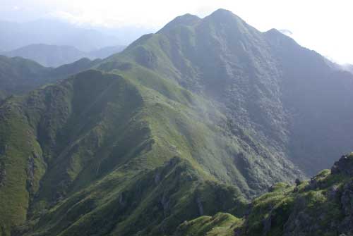
Subtropical wet forests are of high ecological value, but naturally scarce worldwide. Jiulianshan National Reserve lies at the hinterland fringe of extremely densely populated eastern China, where road infrastructure is cutting into the remaining tracts of roadless areas (photo: Pierre Ibisch)
 

Roadless Areas and Roadless Ecology
 
Roads are a key component of modern human development. At the same time, however, they represent a major - and dramatically growing - threat to biodiversity. Conservation policy addressing roads is traditionally based on “road ecology,” meaning that conservation accepts to deal with the impacts of existing or planned roads.  In contrast, a science focused on the ecosystem benefits of roadless areas is needed to counter the growing effects of roads globally. The Roadless Initiative of the Society for Conservation Biology (see also www.roadless.online) follows a complementary and more proactive approach – the conservation of the remaining roadless areas, that has the potential to prevent the “contagious development effects” of road building, i.e., the construction of side roads into previously undisturbed areas, and uncontrolled colonisation and degradation of ecosystems. We base this advocacy on a new ecological subdiscipline: roadless ecology – the ecology of roadless areas, as a complement to the well-established road ecology.
 
Research into Roadless Areas
 
Our research follows three main strands – (1) the inventory and monitoring of roadless areas, (2) roadless ecology and ecological evaluation of roadless areas, and (3) policy work for roadless areas conservation.
  1. Inventory of roadless areas: Using available road data such as in the crowd-source OpenStreetMap, we provide first-hand pictures where the remaining roadless areas occur – and where they have vanished. We have provided a unique global map of roadless areas that was published in Science (see bottom of page). Systematic updating allows us to track changes from the current snapshot and thus close the circle from basic data through prioritisation to advocacy.
  2. Roadless ecology and evaluation of roadless areas according to their conservation value: We look at the ecological properties of roadless areas and the resulting ecosystem functions and services to mankind. For this, we combine comprehensive literature reviews with original (field) research. Spatial analyses and the Ecological Value Index of Roadless Areas (EVIRA) allow us to evaluate the existing roadless areas concerning their ecosystem functionality. We use this to give guidance on which roadless areas to save first and foremost, i.e. how to prioritise.
  3. Making roadless areas conservation policy work: Our greater aim is to put roadless areas on the political agenda, both internationally and nationally. We address governments, NGOs and other civil society groups. Among others, we base ourselves on policy analyses and extract recommendations from them as regards the alignment with other environmental policy goals. We also strive for providing guidance for putting these recommendations into practice.
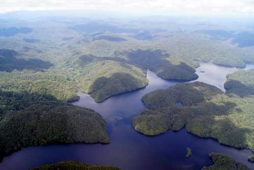
The Amazon Basin is home to several very large and ecologically valuable roadless areas. While southeastern Amazonia has widely fallen victim to contagious development following road construction, good policy may still regulate uncontrolled encroachment in southwestern Amazonia (El Sira Mountains, Peru – photo: Pierre Ibisch)

The Roadless Initiative as a Trans-Sectional Activity within SCB

The Roadless Initiative of the Society for Conservation Biology brings together expertise from a growing number of regions of the Society for Conservation Biology.
 
Ample expertise on roadless areas exists within the North America Region The US Roadless Areas Conservation Rule of 2001, a recent sister of the Wilderness Act of 1964, has been changing the protected area landscape all over that country. There is a fruitful synergy with SCB’s Global Forest Initiative, that has also received significant momentum from SCBNA, because many large roadless areas comprise extensive forests of good conservation status, and vice versa.
 

The Bialowieza forest, stretching on the border between Belarus and Poland, comprises the largest remaining tract of primeval forest in the European lowlands. However, it is not completely unfragmented, with forest roads criss-crossing large parts of it (photo: Adam Wajrak)

The Roadless Initiative proper started in the Policy Committee of SCB’s Europe Region in 2007 (find a full historical account here). The disappearance of some of the last large areas that had remained unfragmented by roads on this densely populated continent was appearing to go largely unnoticed. This clear advocacy gap prodded members of the European Policy Committee to publish a well-received journal article that calls for putting on the political agenda “Roadless and Low-Traffic Areas as Conservation Targets in Europe”. A book chapter in the prizewinning “Handbook of Road Ecology” broadened the picture to the global scale.
 
With symposia at two International Congresses for Conservation Biology, 2013 in Baltimore and 2015 in Montpellier, the SCB Roadless Initiative went global. The Initiative now brings together scientists from three regions: Latin America and Caribbean, North America, and Europe. Ultimately, we strive for expanding the SCB Initiative to cross all regions.
 
Along with this exchange with our peers, we reach out to governmental and non-governmental decision-makers. Prominent examples are meetings with the Commission and Parlamentarians of the European Union, or the co-hosting of a side event on roadless areas at the Rio+20 conference in Rio de Janeiro in 2012.
 
The most important milestone to date is our publication in Science on “A global map of roadless areas and their conservation status” on December 16, 2016 (read the press release).
 

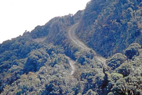
Reclaiming a road in time before large-scale exploitive landuse sets off can allow for the conservation of “new” roadless areas of high ecological value (Carrasco National Park, Bolivia – photo: Stefan Kreft)